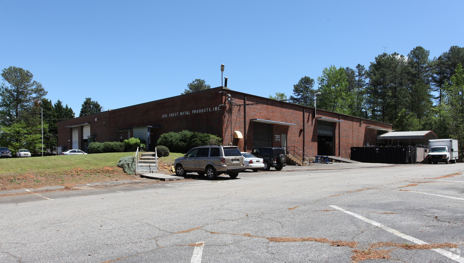
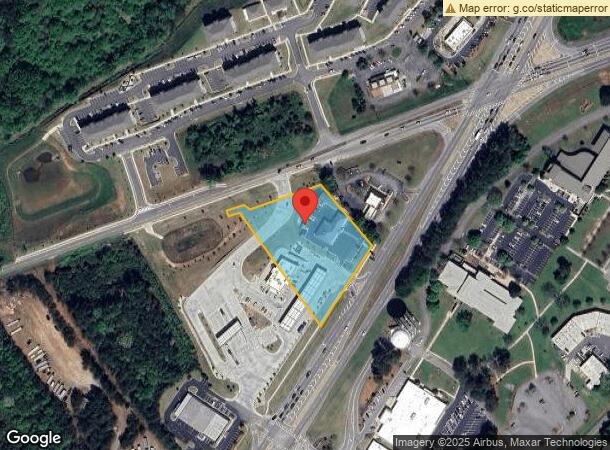
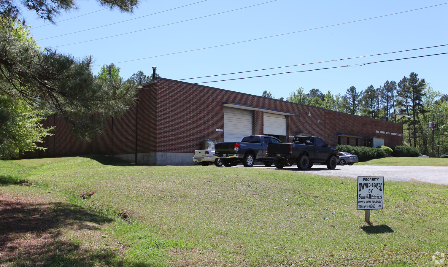
Property Record
467 Hull Rd, Athens, GA 30601
NEARBY LISTINGS FOR SALE OR LEASE
Property Detail
467 Hull Rd
162-026
Com-St-058->00-03
Conveniencestore
6.235 AC - DB 5454/112
X
Clarke
13059C0017F
Georgia
2024
6.24 AC
2024
North Athens
140400
Other Market Areas
5,719 SF
Athens-Clarke County, GA
DEMOGRAPHICS near 467 Hull Rd
1 Mile
3 Mile
5 Mile
2024 Total Population
1,022
25,375
83,165
2029 Population
1,058
25,482
84,144
Pop Growth 2024-2029
+ 3.52%
+ 0.42%
+ 1.18%
Average Age
39
34
33
2024 Total Households
384
9,744
31,674
HH Growth 2024-2029
+ 3.91%
+ 0.33%
+ 1.12%
Median Household Inc
$60,514
$37,552
$45,260
Avg Household Size
2.60
2.40
2.30
2024 Avg HH Vehicles
2.00
2.00
2.00
Median Home Value
$96,268
$142,060
$209,737
Median Year Built
1996
1991
1983
Nearby Places
- Restaurants
- Banks
- Shops
- Fitness
- Groceries
Nearby Properties
Address
Land Use
TOTAL SIZE
Lot Size
Zoning
Address
Land Use
TOTAL SIZE
Lot Size
Zoning
81,812 SF
6.23 AC
C-D (RIV)
Address
Land Use
TOTAL SIZE
Lot Size
Zoning
213,612 SF
3.07 AC
C-D
Address
Land Use
TOTAL SIZE
Lot Size
Zoning
226,339 SF
2.32 AC
C-D (RIV)
Address
Land Use
TOTAL SIZE
Lot Size
Zoning
265,400 SF
2.95 AC
C-D
Address
Land Use
TOTAL SIZE
Lot Size
Zoning
3.16 AC
E-I
Address
Land Use
TOTAL SIZE
Lot Size
Zoning
10,240 SF
6.47 AC
G
Address
Land Use
TOTAL SIZE
Lot Size
Zoning
2,856 SF
39.78 AC
C-G
Address
Land Use
TOTAL SIZE
Lot Size
Zoning
15.29 AC
RS-5
Address
Land Use
TOTAL SIZE
Lot Size
Zoning
94,220 SF
132 AC
E-I
Address
Land Use
TOTAL SIZE
Lot Size
Zoning
136,404 SF
1.72 AC
G
Address
Land Use
TOTAL SIZE
Lot Size
Zoning
108,922 SF
1.34 AC
C-D
Address
Land Use
TOTAL SIZE
Lot Size
Zoning
42,152 SF
4.01 AC
G
Address
Land Use
TOTAL SIZE
Lot Size
Zoning
125,888 SF
1.11 AC
C-D
Address
Land Use
TOTAL SIZE
Lot Size
Zoning
8,357 SF
22.38 AC
RM-1
Address
Land Use
TOTAL SIZE
Lot Size
Zoning
4.06 AC
G
Address
Land Use
TOTAL SIZE
Lot Size
Zoning
8,423 SF
1.07 AC
C-D
Address
Land Use
TOTAL SIZE
Lot Size
Zoning
124,959 SF
20.54 AC
E-I
Address
Land Use
TOTAL SIZE
Lot Size
Zoning
88,250 SF
3.09 AC
C-D
Address
Land Use
TOTAL SIZE
Lot Size
Zoning
1,403 SF
21.64 AC
C-G
Address
Land Use
TOTAL SIZE
Lot Size
Zoning
83,755 SF
1.70 AC
C-D
Address
Land Use
TOTAL SIZE
Lot Size
Zoning
65,817 SF
4.45 AC
G
Address
Land Use
TOTAL SIZE
Lot Size
Zoning
140,375 SF
26.15 AC
E-I
Address
Land Use
TOTAL SIZE
Lot Size
Zoning
3,628 SF
6.57 AC
RM-2
Address
Land Use
TOTAL SIZE
Lot Size
Zoning
46.26 AC
G
Address
Land Use
TOTAL SIZE
Lot Size
Zoning
Address
Land Use
TOTAL SIZE
Lot Size
Zoning
95,561 SF
1.02 AC
C-D (RIV)
Address
Land Use
TOTAL SIZE
Lot Size
Zoning
14,000 SF
42.62 AC
I
Address
Land Use
TOTAL SIZE
Lot Size
Zoning
9,600 SF
12.71 AC
RM-2
Address
Land Use
TOTAL SIZE
Lot Size
Zoning
4,392 SF
8.39 AC
C-G
Address
Land Use
TOTAL SIZE
Lot Size
Zoning
12.87 AC
P
The World's #1 Commercial Real Estate Marketplace
Connect with us
© 2025 CoStar Group
The information above has been obtained from sources believed reliable. While we do not doubt its accuracy we have not verified it and make no guarantee, warranty or representation about it. It is your responsibility to independently confirm its accuracy and completeness. Any projections, opinions, assumptions, or estimates used are for example only and do not represent the current or future performance of the property. The value of this transaction to you depends on tax and other factors which should be evaluated by your tax, financial, and legal advisors. You and your advisors should conduct a careful, independent investigation of the property to determine to your satisfaction the suitability of the property for your needs.